Air Navigation Pro
Napsal: 04. 07. 2014 13:01
Air Navigation Pro v1.3.5
(329,- Kc)
Pozadavky: Android 2.3 a vyssi
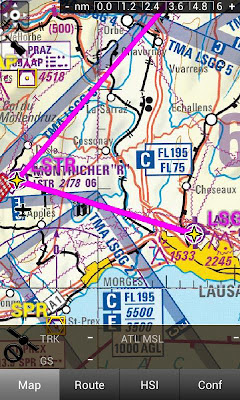
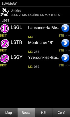
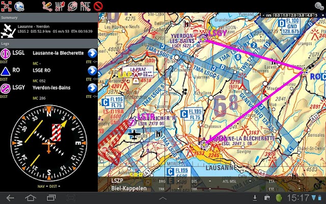
Popis: Air Navigation for Android is a real-time aircraft navigation application with integrated flight planning. Using the GPS receiver (integrated or external) and accelerometers of the Android it can emulate different types of real IFR or VFR aircraft navigation instruments. Using the navigation plan editor, you can prepare and store navigation plans and use them in the cockpit with the moving map.
Screen:
What's in this version:
- k teto verzi se uz neuvadi
- nejnovejsi verze je v 1.4.3
- FIXED THE BLANK MAP FOR A FEW DEVICES
- Possible fix for the crash on exit
- Allow making the waypoints smaller
- Advanced settings to disable waypoints becoming smaller when zoomed out
- Fix toponyms that were cut
- Fix missing airspaces when drawing with AGG
- New database for waypoints and airspaces
- Fix crash on searching for waypoints
- Fix Map Activation Error
Vice info:
Stahuj zde:
Air Navigation for Android is a real-time aircraft navigation application with integrated flight planning. Using the GPS receiver (integrated or external) and accelerometers of the Android it can emulate different types of real IFR or VFR aircraft navigation instruments. Using the navigation plan editor, you can prepare and store navigation plans and use them in the cockpit with the moving map.
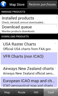
It contains free maps of the entire world as well as official aviation charts for many countries. The application costs a fraction of the price of a dedicated portable aviation GPS.
Worldwide database
Air Navigation comes fully loaded with worldwide aviation waypoints (more than 160000). The database also contains airspace information for many countries. By using the database and maps, you can quickly plan your route, distance and estimated time of flight.
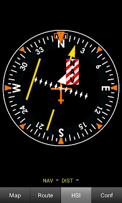
Real aircraft instrument HSI
Air Navigation imitates real aircraft instrument, gathering information from GPS to create realistic image. With Air Navigation you will not only get a moving map but also realistic images of the instrument HSI.
(329,- Kc)
Pozadavky: Android 2.3 a vyssi
Popis: Air Navigation for Android is a real-time aircraft navigation application with integrated flight planning. Using the GPS receiver (integrated or external) and accelerometers of the Android it can emulate different types of real IFR or VFR aircraft navigation instruments. Using the navigation plan editor, you can prepare and store navigation plans and use them in the cockpit with the moving map.
Screen:
What's in this version:
- k teto verzi se uz neuvadi
- nejnovejsi verze je v 1.4.3
- FIXED THE BLANK MAP FOR A FEW DEVICES
- Possible fix for the crash on exit
- Allow making the waypoints smaller
- Advanced settings to disable waypoints becoming smaller when zoomed out
- Fix toponyms that were cut
- Fix missing airspaces when drawing with AGG
- New database for waypoints and airspaces
- Fix crash on searching for waypoints
- Fix Map Activation Error
Vice info:
Kód: Vybrat vše
https://play.google.com/store/apps/details?id=com.xample.airnavigationKód: Vybrat vše
http://www.tusfiles.net/8x87flmuzgc0
http://unlimitzone.com/g1llw5a0zhjs/ArNvgtP35.rar.html
http://uloz.to/xxW2qDTk/air-navigation-pro-v1-3-5-zip
It contains free maps of the entire world as well as official aviation charts for many countries. The application costs a fraction of the price of a dedicated portable aviation GPS.
Worldwide database
Air Navigation comes fully loaded with worldwide aviation waypoints (more than 160000). The database also contains airspace information for many countries. By using the database and maps, you can quickly plan your route, distance and estimated time of flight.
Real aircraft instrument HSI
Air Navigation imitates real aircraft instrument, gathering information from GPS to create realistic image. With Air Navigation you will not only get a moving map but also realistic images of the instrument HSI.