Marine Weather | SailGrib
Napsal: 18. 08. 2016 08:21
Marine Weather | SailGrib v1.9.2
(190,- Kc)
Pozadavky: Android 4.0.3 a vyssi
Popis: Sailing weather and tides forecast maps designed for and by sailors.
Screen:
What's in this version:
V1.9.2
- new German translation
- new grib source : GMN
- Iridium optimised grib files
- updated map library
- bug corrections
V1.9.1
- New Météo France models
- Arpege - Global 0.5°
- Arpege - Europe - High Resolution 0.1°
- Arome - France - Ultra High Resolution 0.025°
10 Jun 2015 - V1.9.0
- meteogram :weather forecast accross time for a location
- new models : gfs 1°, WW3, MyOcean ENWS
- bug corrections
Vice info:
Stahuj zde:
Patched
Original (untouched)
With SailGrib, enjoy viewing weather and tide forecast on your Android device.
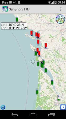
Select the map that you want to get data for
- request the grib file, view its data on SailGrib.
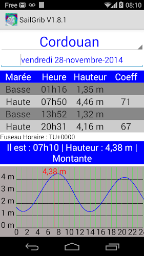
- tide calculations are done directly on your device, no need for an internet connection
The area selection is very simple: pan and zoom on the map.
The data request is done through SailGrib, Saildocs,Great Circle. SailGrib gets grib files by direct download or through an email exchange.
Features
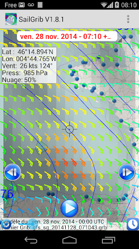
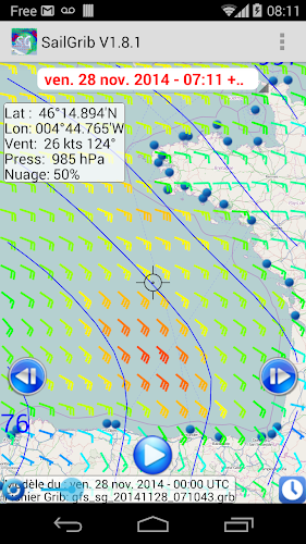
- choose a map and overlay weather forecast data,
- download data using the best Grib files providers : SailGrib, Great Circle, Saildocs, MeteoConsult,...
- specify the request to your needs,
- request can be adjusted to match a maximum file size
- can be used with satellite phone email services like XGate with optimizer, the Iiridium Go or the AxcessPoint.
- offlline maps capability combined with satellite mail allows usage at sea.
- view weather overlays together on the same map
With SailGrib, you can download and view the following data:
- Wind (10m above sea level)
- Pressure (reduced to mean sea level)
- Precipitation (accumulated over 6 hours)
- Total cloud cover
- Air Temperature ( 2m above ground)
- Wave (significant wave height, mean wave direction and period)
- CAPE
- Tidal or oceanic currents
With SailGrib, you can specify the following parameters for your grib file request:
- grib provider : SailGrib, Great Circle, SailDocs, Open Skiron, MeteoConsult, GMN, ....
- request method : direct download (SailGrib, Great Circle, MeteoConsult, GMN) or email (Great Circle and SailDocs)
- grid resolution: from very high resolution to 2.5°
- time step between forecasts :from 1 hour to 12 hours depending on models
- number of days for the forecast: from 1 to 14 depending on model
- maximum file size. SailGrib estimates the size of the grib file you request and adjust the grid resolution and the time step to make sure your file will size be lower than your set limit.
With SailGrib, you can view the following data:
- Windbarbs
- Isobars
- Precipitation maps
- Cloud cover maps
- Temperature maps
- Waves maps and arrows
- CAPE map
- Currents
(190,- Kc)
Pozadavky: Android 4.0.3 a vyssi
Popis: Sailing weather and tides forecast maps designed for and by sailors.
Screen:
What's in this version:
V1.9.2
- new German translation
- new grib source : GMN
- Iridium optimised grib files
- updated map library
- bug corrections
V1.9.1
- New Météo France models
- Arpege - Global 0.5°
- Arpege - Europe - High Resolution 0.1°
- Arome - France - Ultra High Resolution 0.025°
10 Jun 2015 - V1.9.0
- meteogram :weather forecast accross time for a location
- new models : gfs 1°, WW3, MyOcean ENWS
- bug corrections
Vice info:
Kód: Vybrat vše
https://play.google.com/store/apps/details?id=com.sailgrib.paidPatched
Kód: Vybrat vše
https://webshare.cz/file/5k946L46Y7/marine-weather-sailgrib-v1-9-2-patched-apk
https://userscloud.com/aq2iwdgd92ox
https://filescdn.com/u79jbt9xmjtg
http://ul.to/dmvaz8ukKód: Vybrat vše
https://webshare.cz/file/3D07n1Pqtm/marine-weather-sailgrib-v1-9-2-original-apk
https://userscloud.com/d80gsw4306zi
https://filescdn.com/y7c44tm8b8nx
http://ul.to/sbd2h9x8Select the map that you want to get data for
- request the grib file, view its data on SailGrib.
- tide calculations are done directly on your device, no need for an internet connection
The area selection is very simple: pan and zoom on the map.
The data request is done through SailGrib, Saildocs,Great Circle. SailGrib gets grib files by direct download or through an email exchange.
Features
- choose a map and overlay weather forecast data,
- download data using the best Grib files providers : SailGrib, Great Circle, Saildocs, MeteoConsult,...
- specify the request to your needs,
- request can be adjusted to match a maximum file size
- can be used with satellite phone email services like XGate with optimizer, the Iiridium Go or the AxcessPoint.
- offlline maps capability combined with satellite mail allows usage at sea.
- view weather overlays together on the same map
With SailGrib, you can download and view the following data:
- Wind (10m above sea level)
- Pressure (reduced to mean sea level)
- Precipitation (accumulated over 6 hours)
- Total cloud cover
- Air Temperature ( 2m above ground)
- Wave (significant wave height, mean wave direction and period)
- CAPE
- Tidal or oceanic currents
With SailGrib, you can specify the following parameters for your grib file request:
- grib provider : SailGrib, Great Circle, SailDocs, Open Skiron, MeteoConsult, GMN, ....
- request method : direct download (SailGrib, Great Circle, MeteoConsult, GMN) or email (Great Circle and SailDocs)
- grid resolution: from very high resolution to 2.5°
- time step between forecasts :from 1 hour to 12 hours depending on models
- number of days for the forecast: from 1 to 14 depending on model
- maximum file size. SailGrib estimates the size of the grib file you request and adjust the grid resolution and the time step to make sure your file will size be lower than your set limit.
With SailGrib, you can view the following data:
- Windbarbs
- Isobars
- Precipitation maps
- Cloud cover maps
- Temperature maps
- Waves maps and arrows
- CAPE map
- Currents
